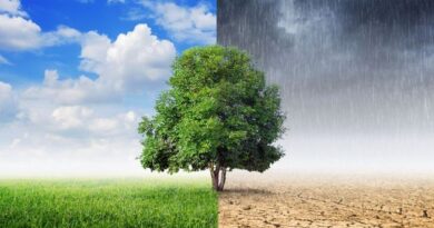
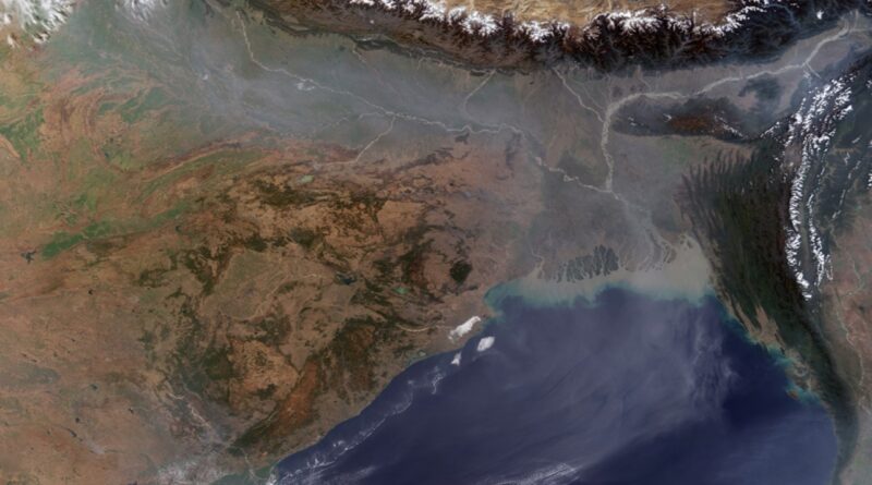
Atmospheric Brown Cloud (ABC)/Asian Brown Cloud
The ABC originally referred to the enormous blanket of pollution spreading across Asia, distorting normal weather patterns in the region and threatening to devastate many countries’ economies. It was called the ‘Asian Brown Cloud’ in 2002, when a UN report first warned of this layer of pollution comprising ash, acids and aerosols. At that time, the two-mile thick haze extended ominously across the most densely populated areas of the world: southern, southeastern, and eastern Asia. Subsequently, however, similar patterns were detected elsewhere in the world and it was renamed ‘Atmospheric Brown Cloud’.
Asia is particularly vulnerable as the ABC causes changes in the winter monsoon season, sharply reducing rain over northwestern parts of the continent and increasing rain along the eastern coast. However, India’s scientific community have said the atmospheric brown clouds over Asia are a seasonal, temporary phenomena which may look bad, but have none of the catastrophic implications mentioned in the UN report.
Clouds
When the moist air ascends, it expands, loses temperature, becomes cool, and gets saturated. With further decrease in temperature beyond the dew point, condensation of the moisture takes place high up in the air and it results in the formation of clouds. Clouds are droplets of water or tiny ice crystals which collect around the dust particles present in the atmosphere. The water droplets and tiny ice crystals that remain suspended in the air can be disturbed by the slightest movement of the air. All forms of precipitation occur from the clouds. It should be noted that not all clouds yield precipitation but no precipitation is possible without the clouds.
The clouds play a major role in the heat budget of the Earth and the atmosphere, as they reflect, absorb and diffuse some part of the incoming solar radiation. They also absorb a part of the outgoing terrestrial radiation and then re-radiate it back to the Earth’s surface. Whenever there are clouds in the sky, some sort of precipitation always occurs, although we do not feel it on the Earth. Much of it is re-evaporated during its descent through the warm and dry air. Clouds are more common on the windward slopes of the mountains than on the leeward slopes. Clouds are more frequent during the cyclones than during the anticyclones.
Types of Clouds
Luke Howard, an English biologist, was the first to classify clouds in 1803. He used Latin names which are still in vogue. Clouds are usually classified on the basis of altitude, shape, expanse, density, colour, transparency, opaqueness, moisture content, etc. They exist at various elevations from the sea level to about 20 km above the sea level. There are three basic groups depending upon the height and shape of clouds. These are the cirrus clouds, the cumulus clouds and the stratus clouds.
1. Cirrus (Curl of Hair) Clouds
Cirrus clouds are formed at high altitudes (8,000 – 12,000m). Being at considerable height these clouds are formed of ice crystals and therefore are white and thin. They are detached, fibrous, feathery, often with silky sheen in direct sunlight.
2. Cumulus (Heap) Clouds
Cumulus clouds look like cotton wool. They are generally formed at a height of 4,000 -7,000 m. They exist in patches and can be seen scattered here and there. With a flat base on rising they appear like domes at the top. Their appearance and structure is like that of a Cauliflower.
3. Stratus (Layer) Clouds
As their name implies, these are layered clouds covering large portions of the sky. These clouds are generally formed either due to loss of heat or the mixing of air masses with different temperatures.